The data sources will be scanned and transferred to a GIS tool (ArcGIS), and all data layers will be geo-referenced with the same projection system. Then, all needed data in layers will be digitized using Arc Editor Tool.
After digitalization of the data, the vector maps will be created for each factors and the attributes will be entered manually (lithology, land use and soil type, transmissibility, piezometric water levels and water quality parameters) or computed automatically (distance from lineaments, springs and wells, water bodies) using the tools in ArcGIS.
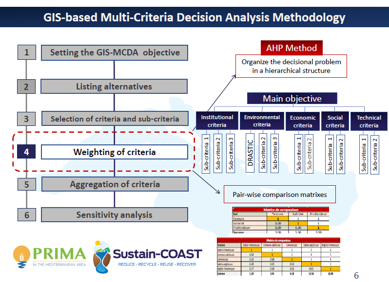
All created vector layers will be converted into the raster format and each sub criteria will be weighted with the rating value.
The last action will concern the creation of the suitability map using “Weighted Linear Combination” (WLC) aggregation method with available special data for each case study area which can cause stress on groundwater pollution. In addition, a sustainability map will be created by using some methods such as DRASTIC, SINTAC.