Description:
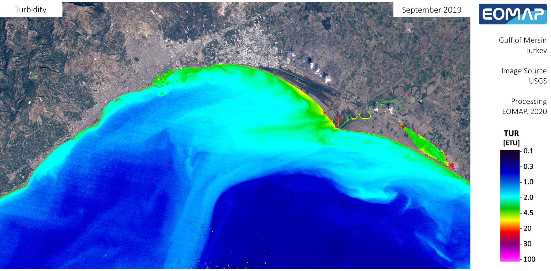
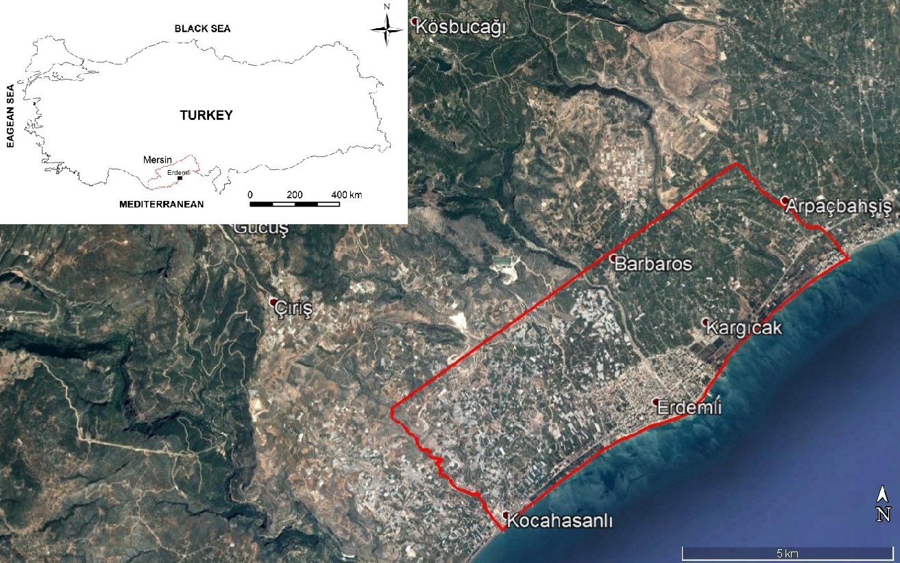
The Erdemli coastal aquifer (ECA) is located about 30 km west of the Mersin city center (in SE Turkey), covering an area of 45 km2 between the latitudes 36°34′–36°39′ N and longitudes 34°14′–34°21′ E. The population of the Erdemli district is 140,331 people, majority of which is primarily engaged in agricultural activities. A sizeable portion of the region consists of agricultural areas such as greenhouses and citrus orchards. In the district, all kinds of fruits and vegetables are grown; especially lemon, banana and tomato are very common products. The southern part of the ECA area, which is very close to the Mediterranean coast, is mainly composed of alluvial deposits, while the northern highlands are composed of carbonate rocks with many karstic features (e.g., sinkholes, caves, etc.) The rivers within the study area are mostly ephemeral in nature and flow during the wet season in response to seasonal rains and snowmelt. In the region, mainly in the Mediterranean coastal areas, groundwater from the coastal aquifer is used extensively to meet domestic and agricultural irrigation water demands.
Specific problems
The main problems in the region are the intensive use of groundwater, decrease in quantity and quality of surface and groundwater due to increasing droughts, agricultural activities and untreated wastewater discharges.
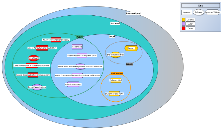
List of stakeholders
- Erdemli Kocahasanlı Irrigation Association
- Mersin Environment and Urban Planning Directorate
- Erdemli Municipality
- Erdemli Reeves Association
- Erdemli District Directorate of Agriculture and Forestry
- Local agricultural producers
Map
Stakeholders mapping